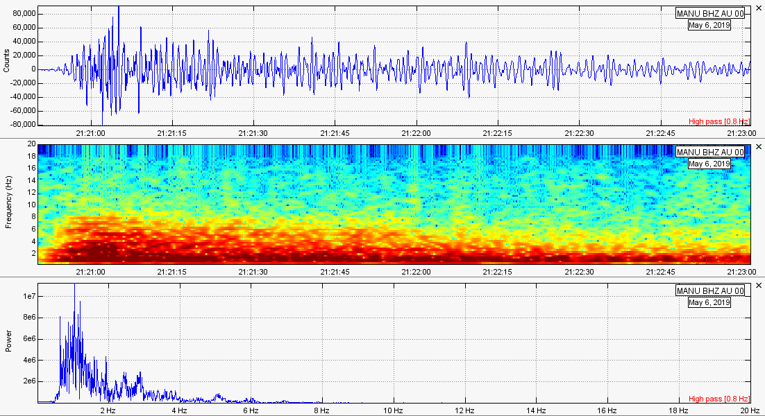
 Please click the title of this post or "read more" to continue... 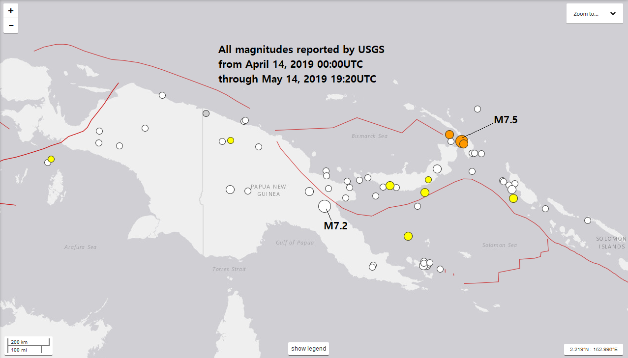 Papua New Guinea, a nation which resides north of Australia, has been seeing an interesting increase in seismicity lately. In a little more than a week, two earthquakes above M7.0 have struck the area including many earthquakes above M4 and M5. The M7.2 first struck on May 6, 2019 at 126.9km in depth. Then, about 8 days later, a M7.5 struck to the northeast on May 14, 2019. This can be seen on the map above. Since the most recent large earthquake was larger than the last one, are these possibly foreshocks indicating a larger event is just down the road? I sure hope not but it is possible. However I must say it could be a coincidence seeing that these two events above M7 occurred on different faults, as can be seen on the map above. So it is all up in the air right now. However I suggest to remain prepared if you live anywhere in these areas. If you wish to see the locations of the stations I use in this post, please CLICK HERE. Let me know what you think about these events. I am going to show the two events larger than M7 via the USGS event pages, seismic plots, and helicorder plots as well. The tectonic summary given under the event pages was written by USGS. M7.2 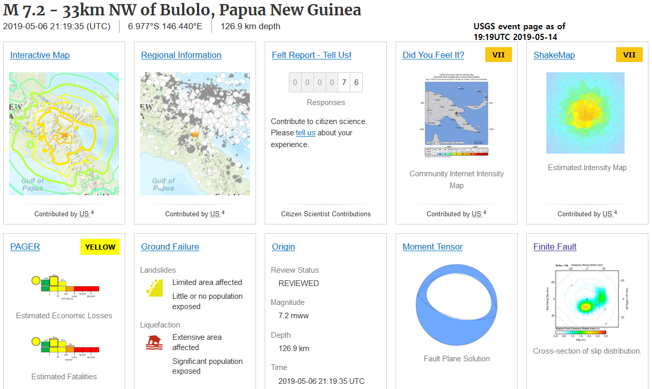 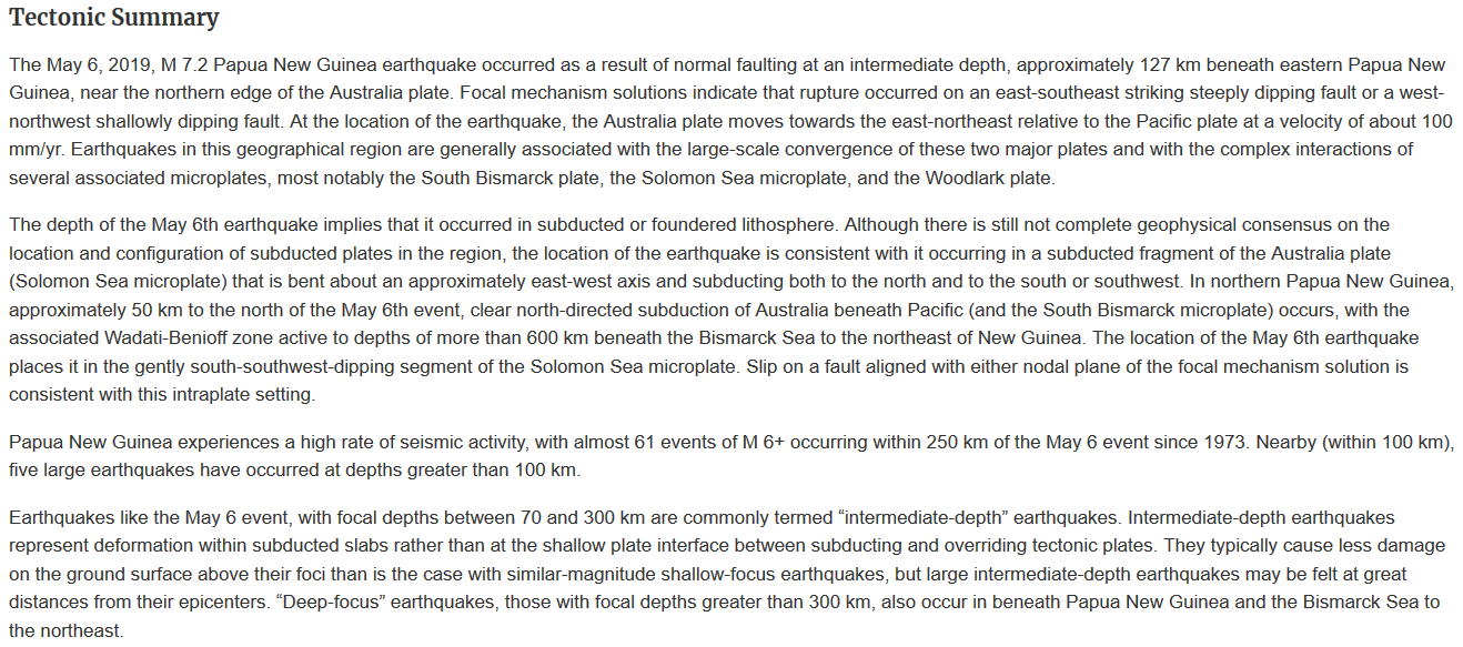  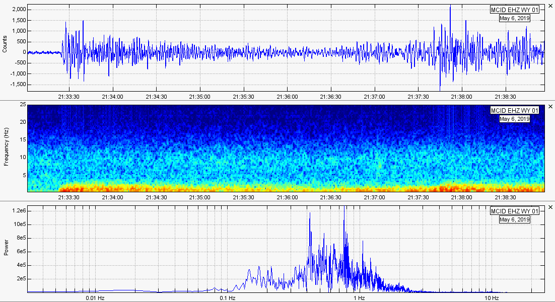 Teleseism 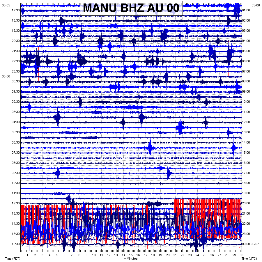 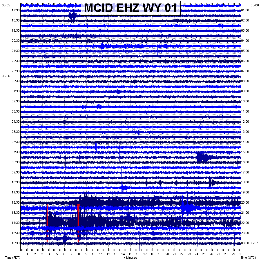 M7.5  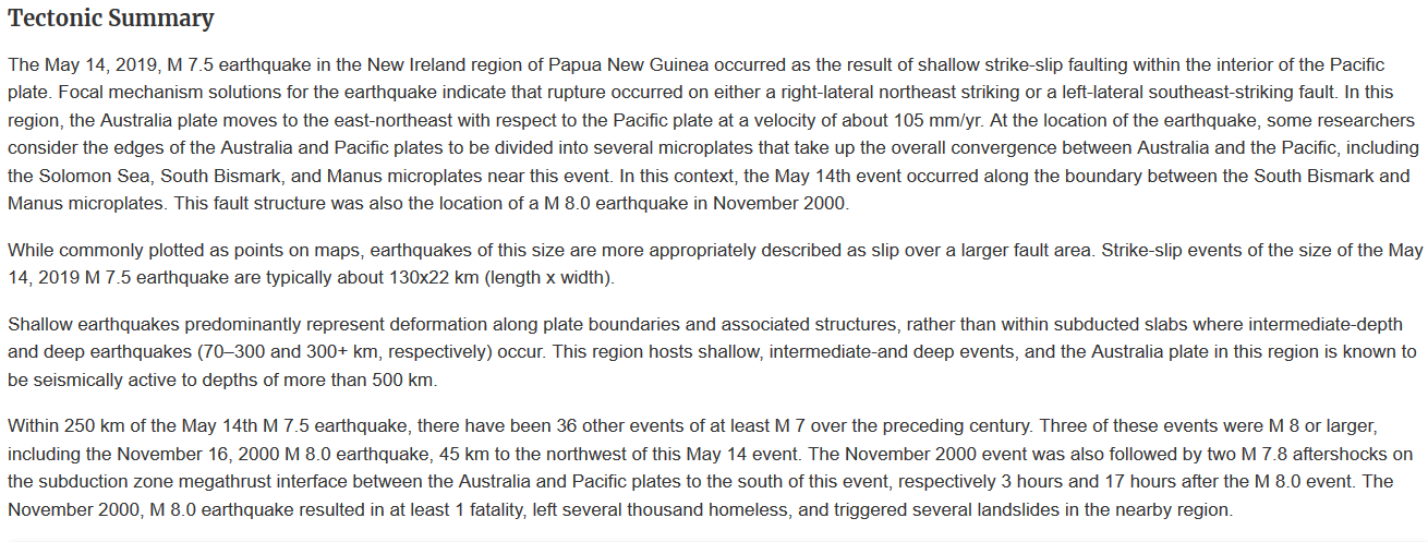 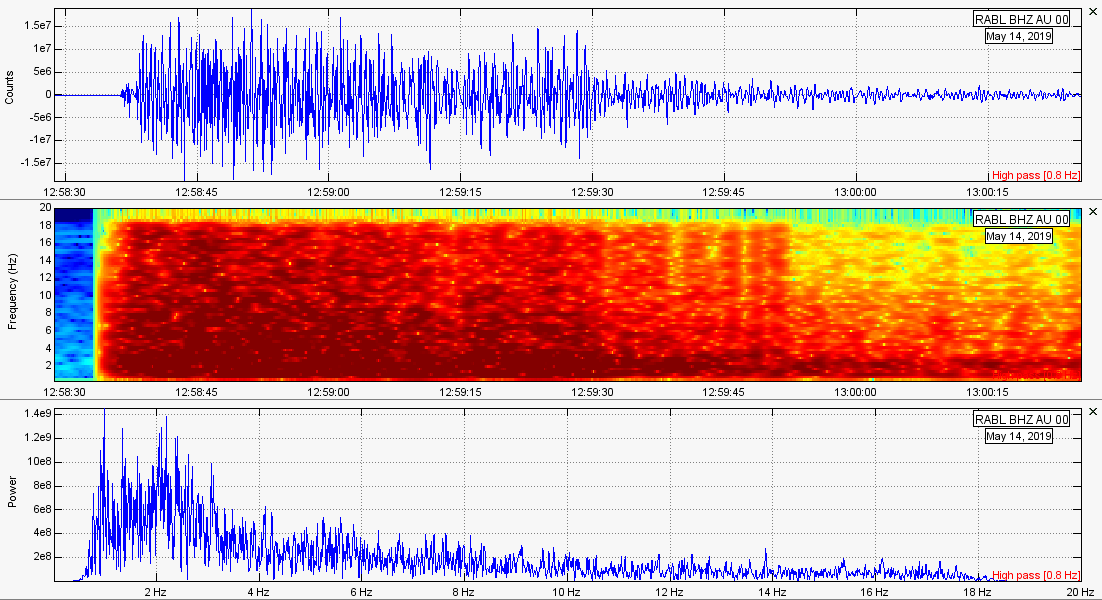 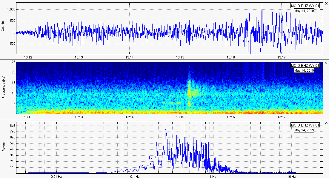 Teleseism 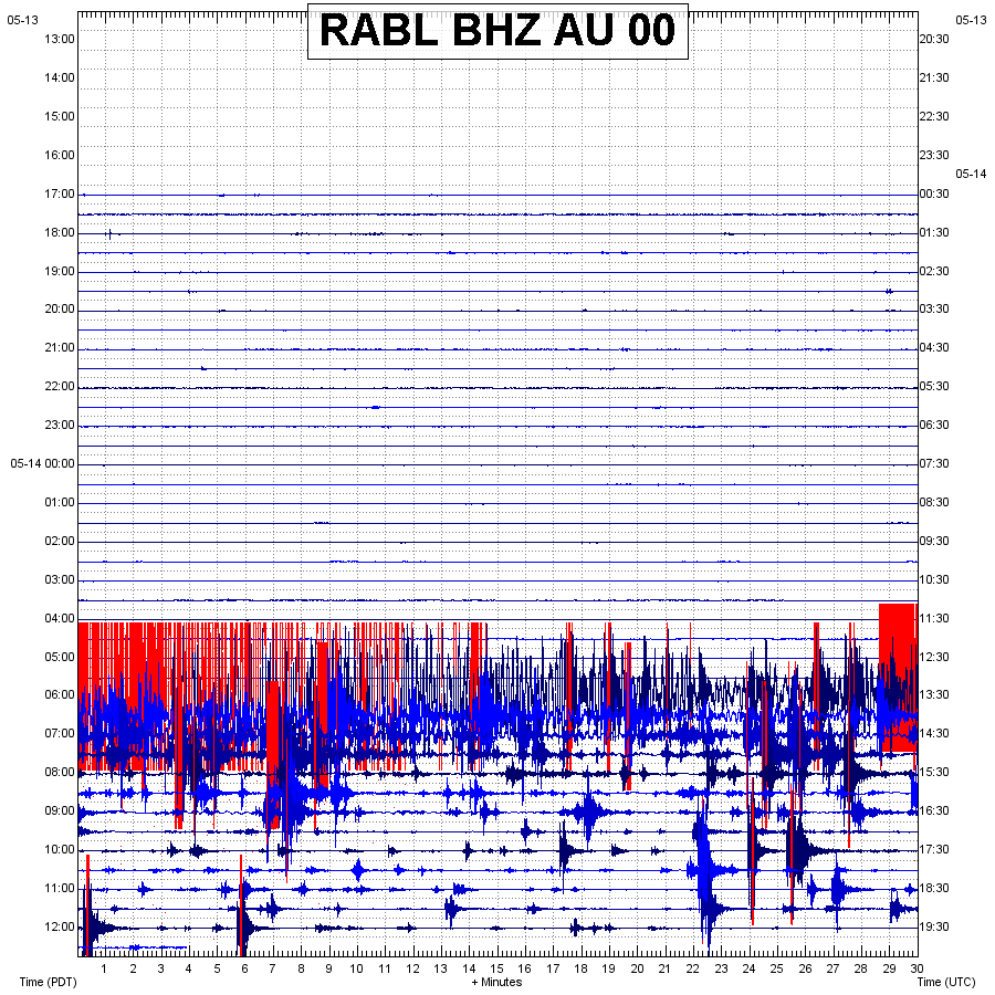 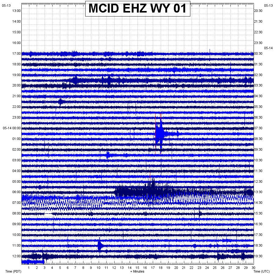
0 Comments
Leave a Reply. |
AuthorBen Ferraiuolo is a fast learner and someone who will always stand for the truth. Visit "About Me" for more! Archives
November 2019
Categories |
 RSS Feed