 Hey there guys. A very interesting earthquake just struck off the east coast of Greenland, north of Iceland. It occurred just 75 miles (120km) west of Jan Mayen Island. It was a magnitude 6.8 earthquake at 10km in depth and it occurred at 1:49UTC November 9, 2018, which is also 5:49pm Pacific Time November 8, 2018. I will show seismic helicorders and plots of this event. PLEASE CLICK THE TITLE OF THIS POST OR "READ MORE" TO READ MORE! 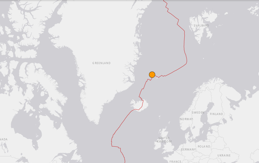 As you can see in the image above, this earthquake occurred in a very peculiar location. Of course earthquakes happen here from time to time but we really don't see large earthquakes occurring near this area very often. 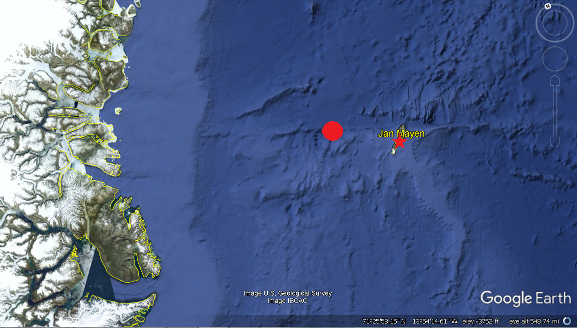 A zoomed-in look at the location of this event. The red circle is where the M6.8 occurred and the red star is where seismic station JMIC (NO_JMIC_00_HHZ) is located. For the helicorder and seismic plots below I will use station JMIC, the instrument closest to this event, and station MCID which as you probably know resides at Yellowstone National Park and Caldera. The following are the helicorders showing this large earthquake. 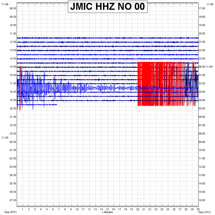 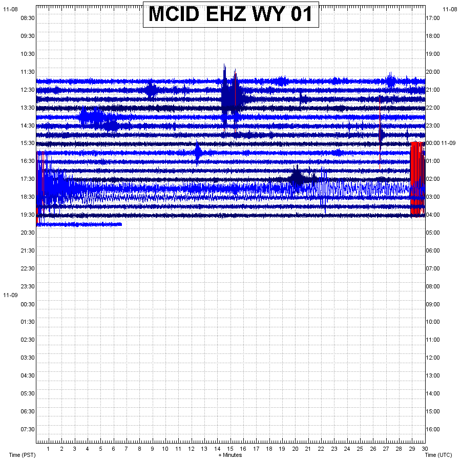 The following seismogram/spectrogram/spectral plots were generated by myself using seismic program SWARM and data retrieved from stations JMIC and MCID. Remember to always read chart labels first before looking at the data. Also pay attention to any captions. 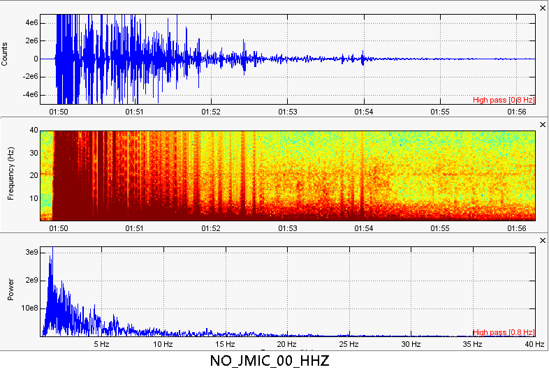 Here are 3 different types of plots for station JMIC, which resides on the island of Jan Mayen. Even though this station was close to this event, it showed some rather strong low frequencies. I am surprised that an earthquake of this size showed such low frequencies just 75 miles from the epicenter. 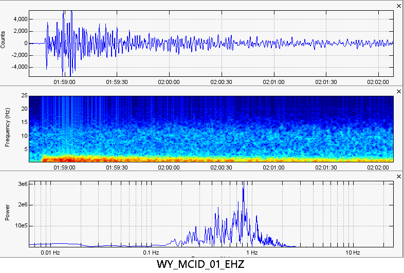 Here are the seismic plots for station MCID at Yellowstone. Yup, this event was pretty strong! So far I have seen no aftershocks which is quite peculiar but it is too soon to tell if that will remain. Anything else major occurs I will update you. Have a great day guys!
0 Comments
Leave a Reply. |
AuthorBen Ferraiuolo is a fast learner and someone who will always stand for the truth. Visit "About Me" for more! Archives
November 2019
Categories |
 RSS Feed