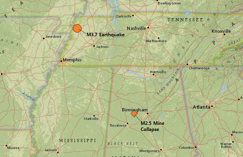
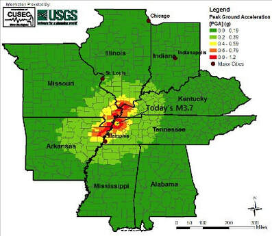
 Hey guys! I am back. This is the first of two blog posts I am putting out today. The next one will be right above this one so don't forget to check it out as well! It will be showing some example of what low frequency, non-volcanic tremor looks like along the Olympic Peninsula in Washington State. However, in this post here I will show some quick data pertaining to the M3.7 in Tennessee which garnered well over 1,000 felt reports on earthquake.usgs.gov. Now although the distance is quite far, there was also a supposed mine collapse in Alabama which registered as a M2.5 earthquake. However as you can see in the image above, geologically-speaking they are not too far from each other. This mine collapse occurred around 3 hours prior to the M3.7 in Tennessee. Could they be connected? Maybe, maybe not. This post also contains seismic audio of these two events. If you haven't already, please click the title of this post or "read more" to continue... M3.7 in Tennessee 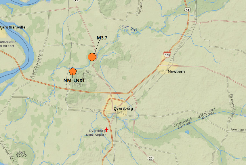 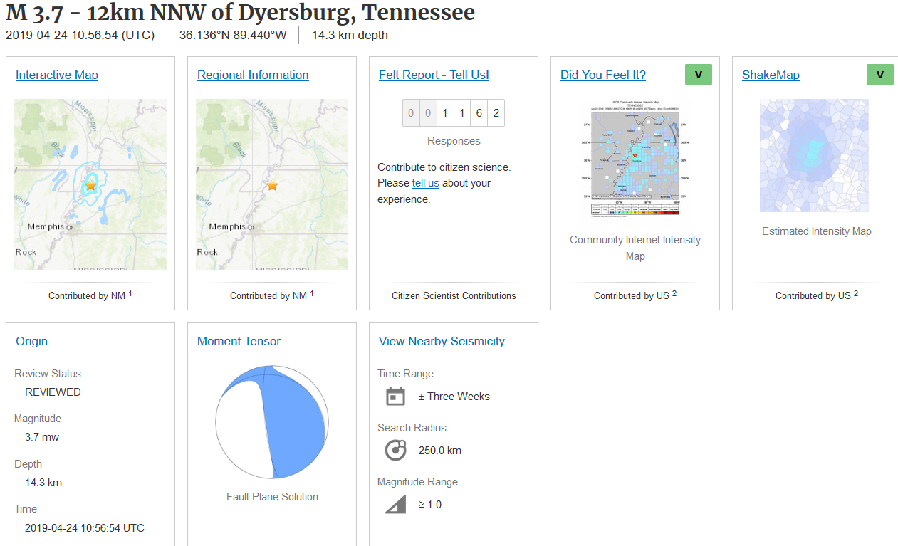 Early in the morning local time on April 24, 2019, residents of western Tennessee were startled to be awoken by a very strong M3.7 earthquake. This occurred occurred around 14.3km in depth and garnered well over 1,000 felt reports in a short amount of time! You can see this via the USGS event page directly above. Also, the image right before the event page shows the location of the M3.7 in regards to the closest seismic station.
If you wish to hear the seismic audio for the following event, please scroll all the way to the end of this post and watch the video. I suggest using headphones but be wary of any sudden increases in volume! Below is the M3.7 earthquake at 14.3km in depth via a seismogram, spectrogram, and spectra plot. The second 3-plot image is zoomed-in to get a better look at the waveforms. 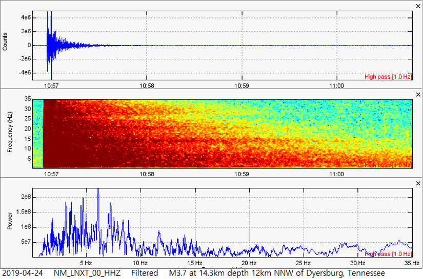 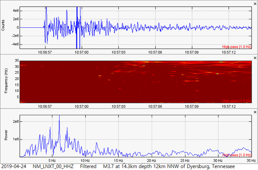 M2.5 Mine Collapse in Alabama 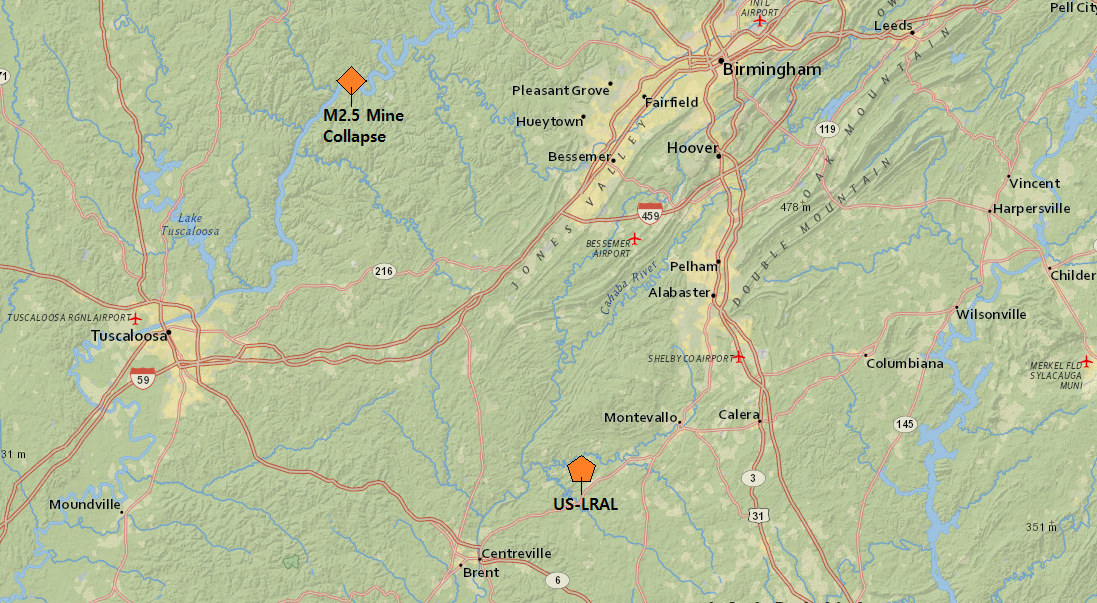 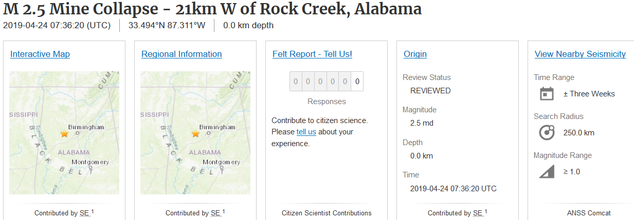 Now something else interesting to note is a supposed mine collapse occurred west of Birmingham, Alabama just 3 hours and 20 minutes prior to the M3.7 on the NMSZ. Although the M2.5 mine collapse is approximately 352km (218mi) southeast of the M3.7, geologically-speaking they are somewhat close. Could they be connected? Maybe, maybe not. It is just strange that a mine would collapse in Alabama 3 hours prior to a strong M3.7 on the New Madrid fault. The location of the M2.5 mine collapse is shown on the map above, in relation to the closest seismic station that was available. The event page is also shown above and it does not look like anyone felt this. Although the depth says 0.0km, which would be sea level, I think it was a little bit deeper than that, making me wonder if this really was a mine collapse or not. Regardless, I am not a professional yet so I could be wrong. Below I will show the helicorder to the closest seismic station to this event: LRAL in the US network. The M2.5 mine collapse is circled in yellow. The larger earthquake you see just a few hours later was the M3.7 in Tennessee. Afterwards, I will show the 3-plot image of this event from LRAL and also will show you the seismic audio to both the M3.7 in Tennessee and the M2.5 mine collapse. Keep an eye out for my next blog post which will likely be up in the next couple hours! 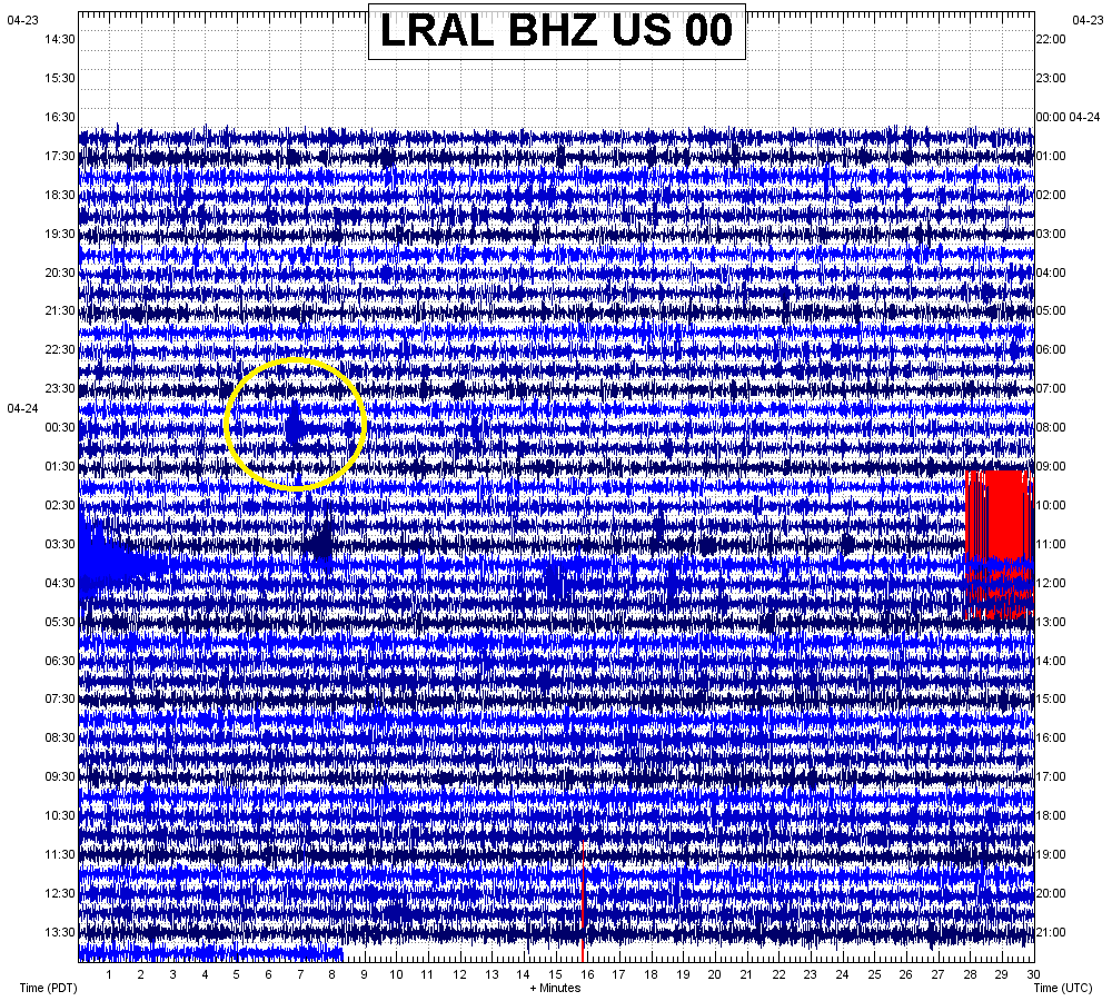 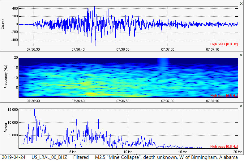 Seismic Audio of those 2 events... This is the link to the video on my channel: CLICK HERE
0 Comments
Leave a Reply. |
AuthorBen Ferraiuolo is a fast learner and someone who will always stand for the truth. Visit "About Me" for more! Archives
November 2019
Categories |
 RSS Feed