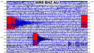
 In this post, as usual, I will show some data and plots pertaining to the M5.3 and M4.4 in Australia, some micro-quakes along the New Madrid Seismic Zone, and the M6.6 off the coast of El Salvador in Central America. Seismic audio is included for the M6.6 and the two earthquakes that struck Australia. As usual, please click the title of this post or "read more" to continue... RESOURCES: M6.6 in El Salvador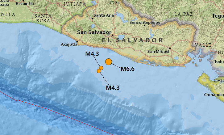 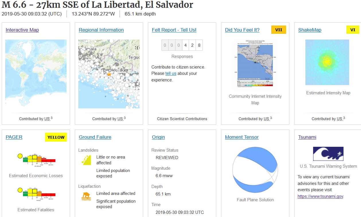 USGS event page for the M6.6 (as of 19:00UTC May 30, 2019). On May 30, 2019 at 9:03UTC a strong M6.6 earthquake at 65.1km in depth struck just off the coast of El Salvador in Central America. At least from what I can tell, and I am no professional, it resulted from normal faulting from the Cocos Plate subducting under the Caribbean Plate. I believe there were no fatalities, thank God, and damage seems to be minimal. It did scare the locals quite a bit, however. The location of the M6.6 and two aftershocks, both clocking in at M4.3, are shown in the map above. The USGS event page is also shown, along with the moment tensor for the M6.6. This event was almost an intermediate depth earthquake, earthquakes that occur between 70km and 300km in depth. Close, but no cigar. Below is an image taken from Wikipedia detailing the plates around this area: 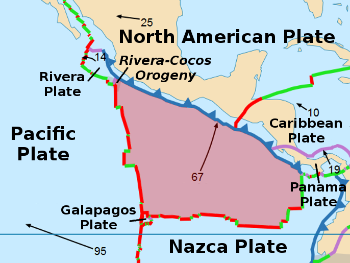 Below is the helicorder plot from one of the closest seismic stations to this event. Plots will also be shown afterwards. Please remember to pay attention to chart labels and any captions beneath any images. Remember, all stations I use in this post can be found in the beginning. Seismic audio will be given at the end of the plots. 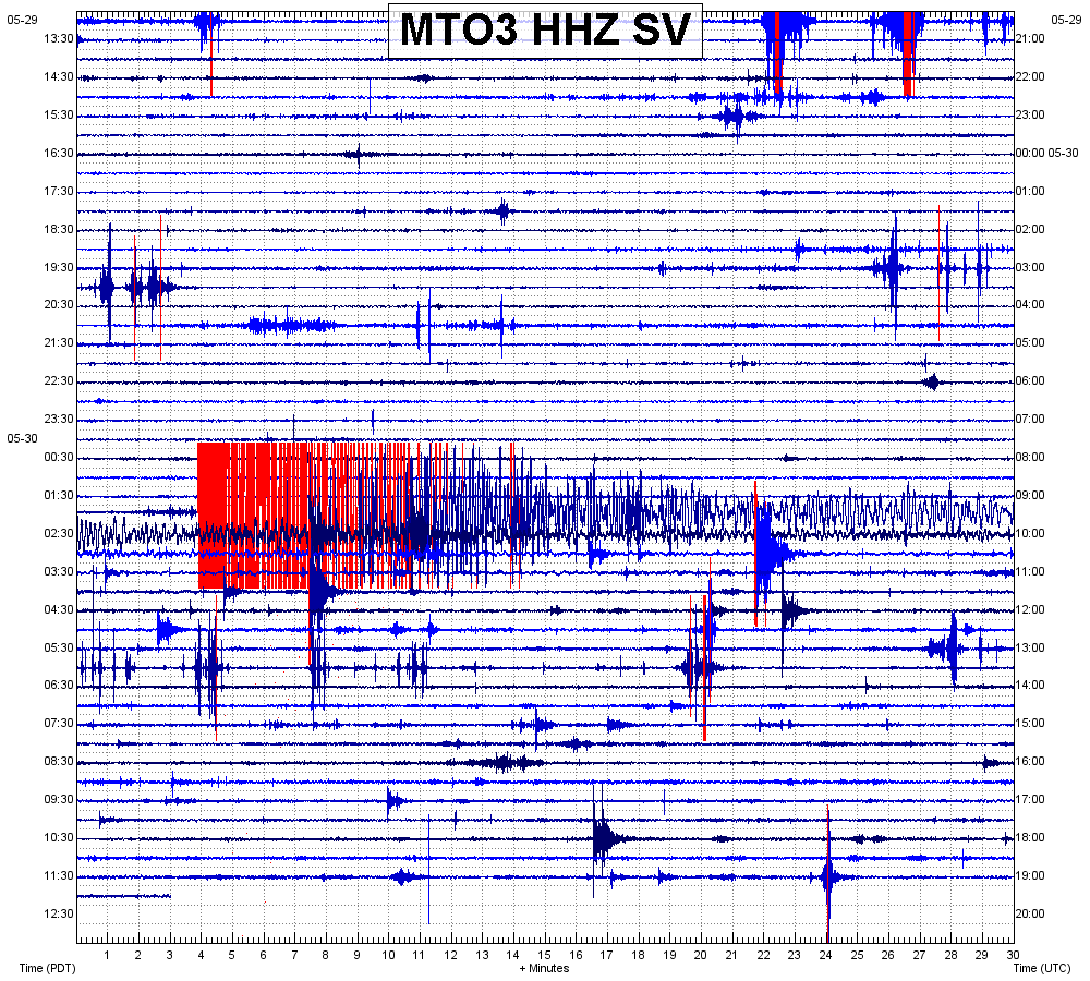 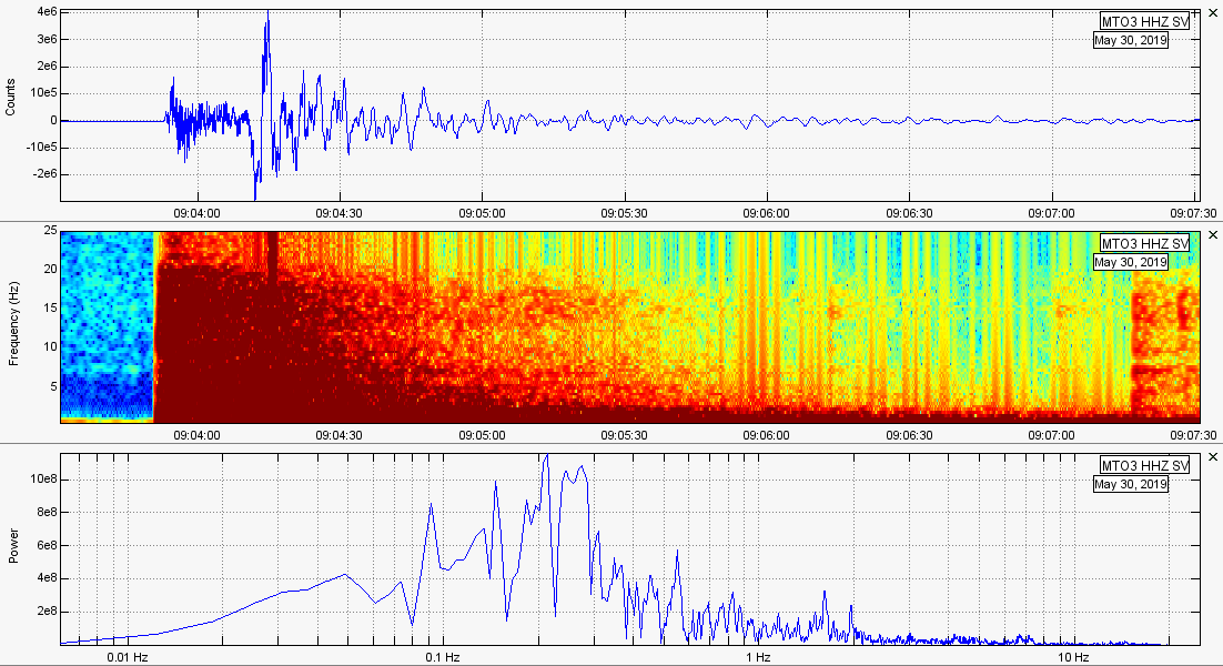 M6.6 unfiltered. 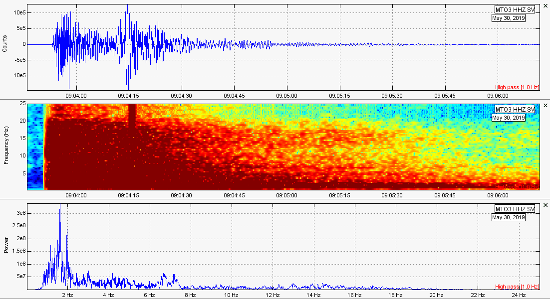 M6.6 but filtered with a 1Hz high pass filter. 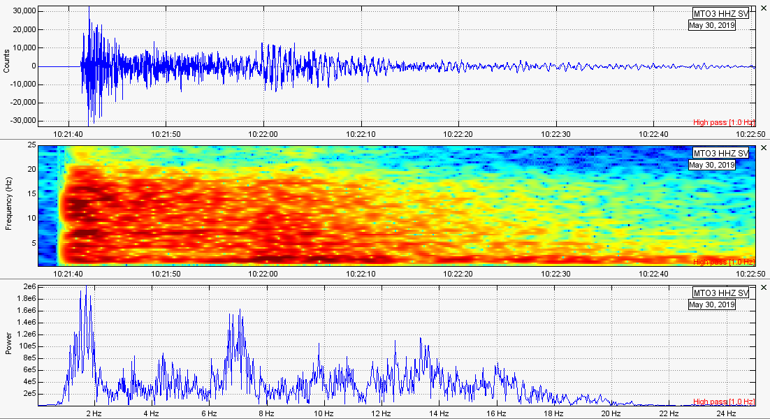 Aftershock M4.3 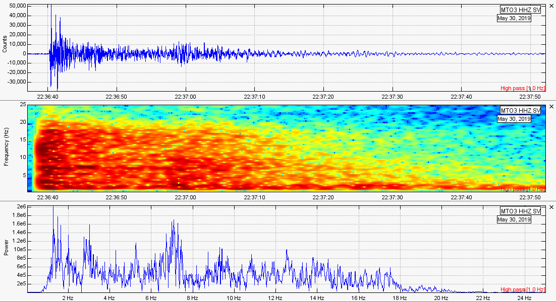 Aftershock M4.3 This was a large enough earthquake to be detected likely on every seismic station in the world. Here is an example from seismic station MCID which resides in the southwestern-most portion of Yellowstone National Park: 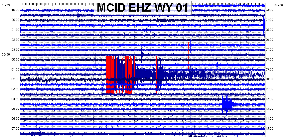 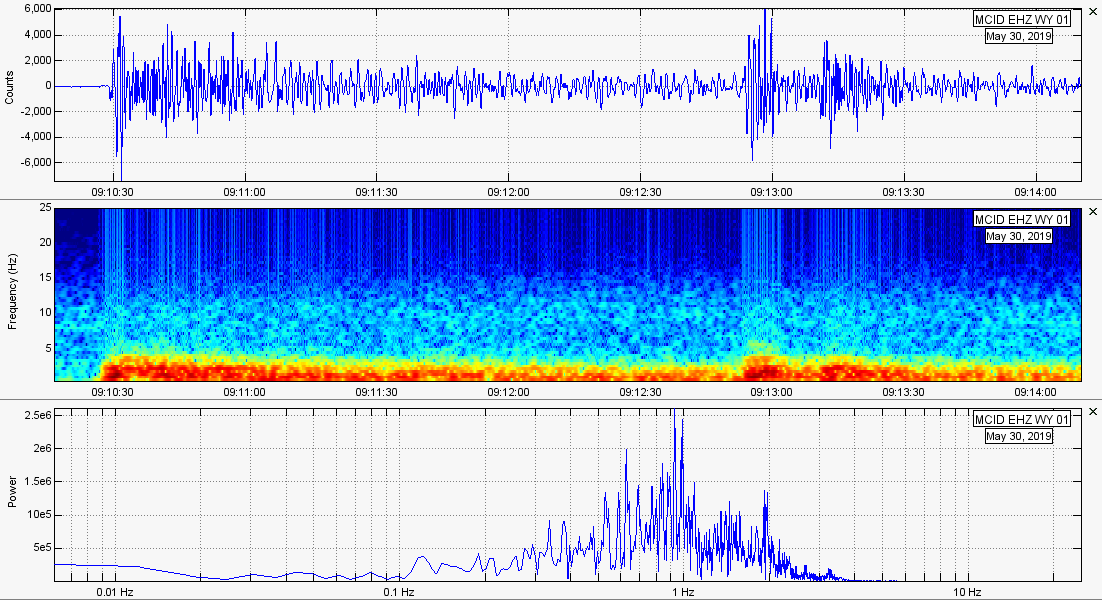
Strange M5.3 and M4.4 in Australia 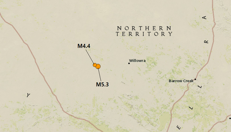 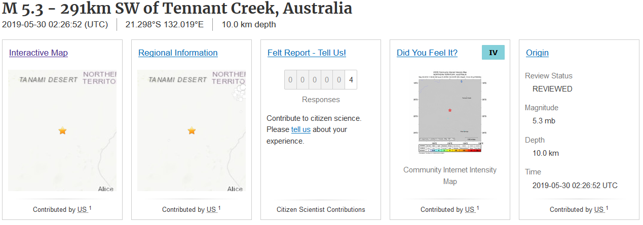 On May 30, 2019 at 2:26UTC a powerful M5.3 earthquake struck a remote part of Australia, supposedly at 10.0km in depth. This event was only felt by 4 people. Well, only 4 people decided to report feeling it to USGS. This is likely due to the very low population in this area. About 5 hours and 12 minutes later, a M4.4 earthquake struck virtually the same location. Both earthquake epicenters are shown on the map above and both earthquakes reportedly have the same depth. There are some faults in this area, though information is somewhat limited. Regardless, below is a slideshow of two images. Sorry, they are kind of small but you can still get the idea. The white image simply shows the locations of faults for Australia. The second image was taken from the USGS earthquake catalog that details all earthquakes reported by USGS since January 1, 2018, almost 1 1/2 years worth of major seismicity for Australia (small events likely are not reported by USGS). Note the epicenter of today's earthquakes are marked in red: Below I will show the helicorder plot from one of the closest seismic stations to these events. After that, I will post the usual plots detailing these events, along with the seismic audio to both events. 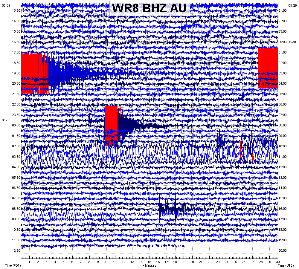 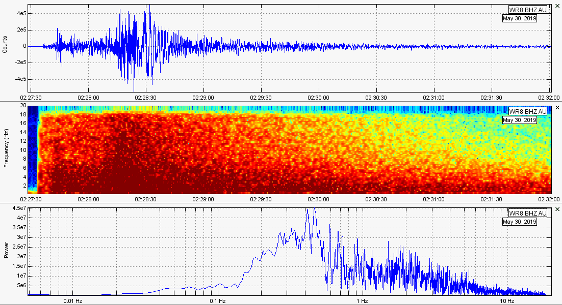 M5.3 unfiltered. 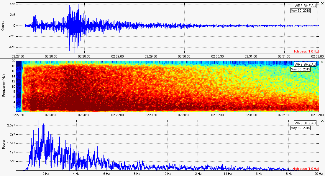 M5.3 with a 1Hz high pass filter. 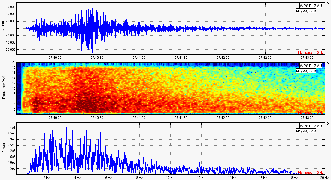 M4.4 aftershock (filtered). Here is the seismic audio for the M5.3. Remember to use headphones but be wary of the volume! Notice how it sounds like thunder? Very cool! And here is the seismic audio for the M4.4: Some micro-quakes along the New Madrid: 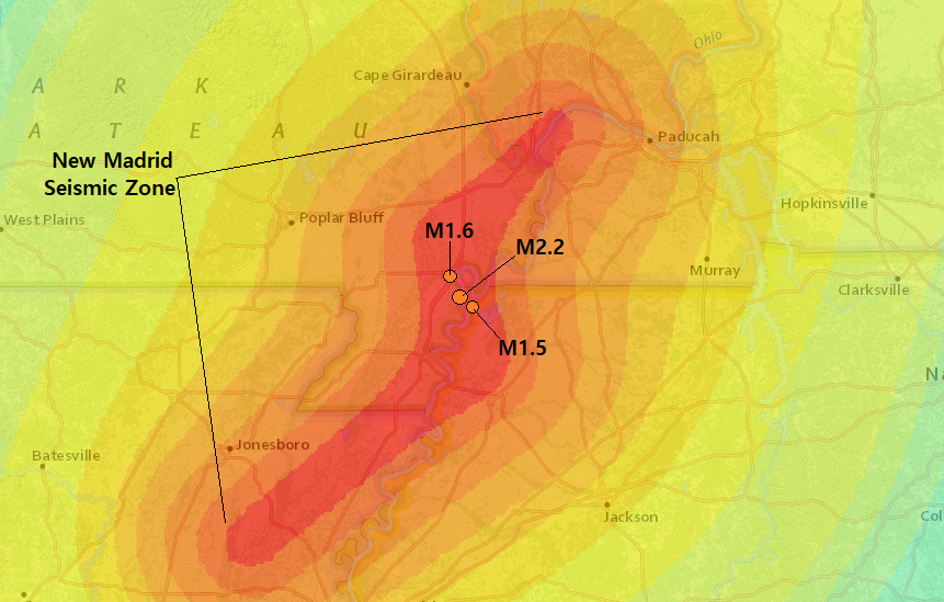 On a side note, there were some micro-quakes today along the New Madrid Seismic Zone (NMSZ). A M2.2, M1.6, and a M1.5. Due to the small magnitudes, it is likely nobody felt these events. However you never know! Remember you can always go to the USGS EQ map button in the beginning of this post to correlate the events for the following plots. 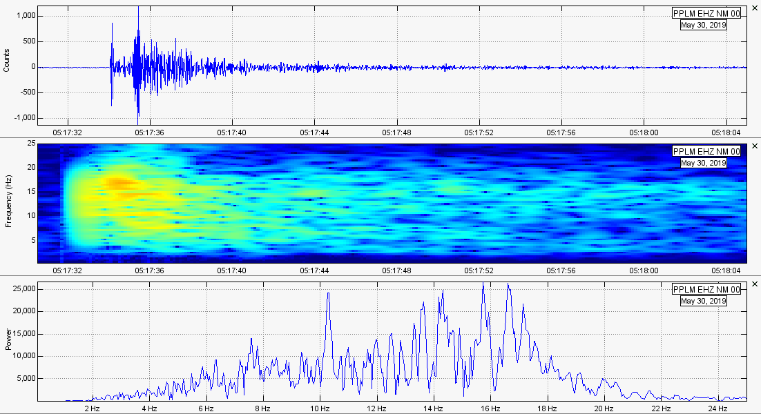 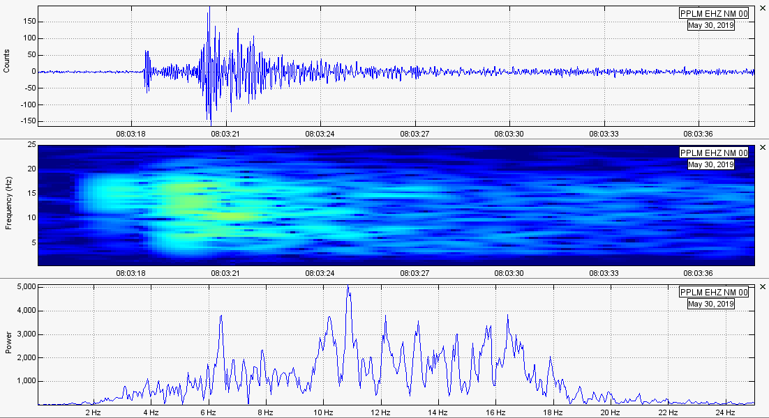 
1 Comment
Jim DeManche
7/2/2019 07:42:24 am
That was a biggy!! Leave a Reply. |
AuthorBen Ferraiuolo is a fast learner and someone who will always stand for the truth. Visit "About Me" for more! Archives
November 2019
Categories |
 RSS Feed