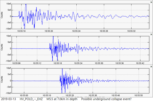
 On March 13, 2019, a very strong M5.5 earthquake struck just to the SE of the infamous Kilauea Caldera volcano on the Big Island of Hawaii. A great many people felt this event and, as you will see in a bit, this was the largest earthquake to strike the Big Island since the volcanic eruptions calmed in early-August 2018. As usual, please click the title of this post or "read more" to continue... 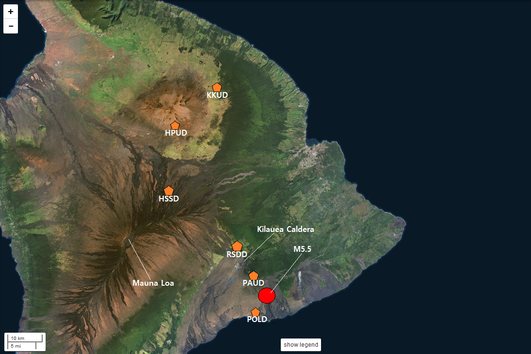 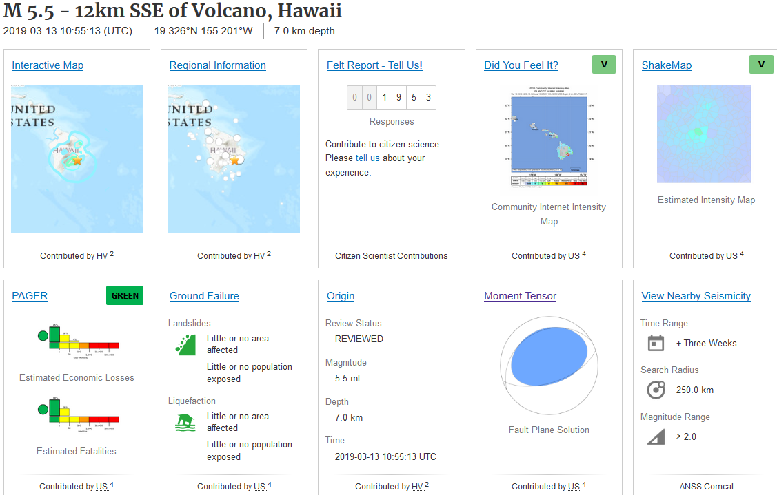 At 10:55UTC on March 13, 2019, a very strong M5.5 earthquake struck the Big Island of Hawaii just to the SE of Kilauea Caldera, at 7.0km in depth. If you wish to see some data pertaining to the mid-2018 eruptions of Hawaii, please go to the "Seismic Events" dropdown menu and click "2018 Kilauea-LERZ Eruptions". The first image you see above is the location of this earthquake in relation to the 6 seismic stations I used for analysis. Kilauea and Mauna Loa are labeled as well. The second image you see is the USGS event page for this M5.5. Notice how, so far, 1,953 people reported feeling this earthquake all around the Big Island? That is alot of people! Even other islands which are part of the Hawaiian chain reportedly felt this large earthquake. Now this earthquake is strange. Notice the moment tensor? Well here is a closer look: 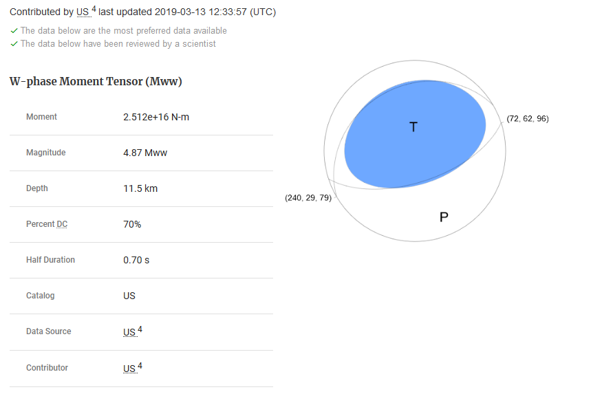 Now please remember I am still somewhat new to seismology and have barely been an amateur seismologist for more than 6 months. I am also still actively learning moment tensors so my understanding of them is minimal at best. However, from what I have seen and heard, these types of "fried egg"-looking moment tensors usually suggest some type of inflation or deflation event. So, was this earthquake caused by an underground collapse? That very well could be and that is the theory I am sticking with until I see otherwise. Below is some data from two tiltmeter stations at Kilauea Caldera. I believe one is on the east edge and one is on the west edge of the volcano. These images were saved at 21:00UTC March 14, 2019. Now this is just preliminary, but is it possible uplift is beginning again for Kilauea? Of course we will have to wait and see. There has also been a small increase in SO2 (sulfur dioxide) emissions. All of this starting right after the M5.5 possible "collapse" event. Check it out: 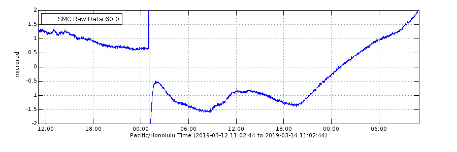 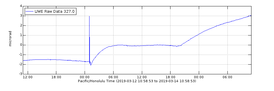 And here is how this M5.5 possible "collapse" event showed up on the 6 stations labeled in the first image of this post: 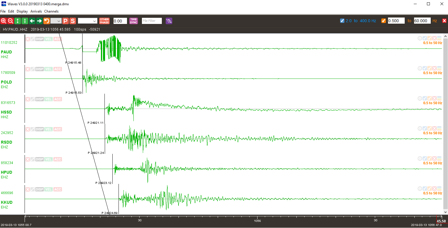 And below is an image showing how this M5.5 earthquake is definitely the largest earthquake to strike Hawaii since the eruptions calmed in August 2018. This can easily be recreated by using the USGS earthquake event catalog on earthquake.usgs.gov: 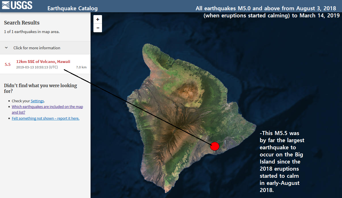 Below I have 2 slideshows showing some plots of this M5.5 earthquake. The first slideshow contains some plots from station POLD, one of the closest stations to this event, and the second slideshow is from station KKUD which is far north of the epicenter. Each slideshow will show 3 images: 1. A zoomed out look of the entire event. 2. A zoomed in look of the earthquake. 3. Some waveform plots showing 3 incremental magnifications. Last, but certainly not least, I will show the helicorders from the 6 seismic stations labeled in the beginning of this post. So, what do you think? Is magma beginning to return to the summit reservoir system? Feel free to let me know below!
0 Comments
Leave a Reply. |
About
This blog is specifically for activity that occurs in Hawaii. In light of 2018's eruptions on the Big Island, I felt it necessary to have a section entirely devoted to events in Hawaii. I now mostly use this blog to update people on volcanic spasmodic tremor which occurs deep within the mantle plume conduit(s) under Pahala, HI. Don't know what spasmodic tremor is? Don't fret! Simply go to the Hawaii menu and click the page about Hawaii Spasmodic Tremor. Archives
February 2020
Categories |
 RSS Feed